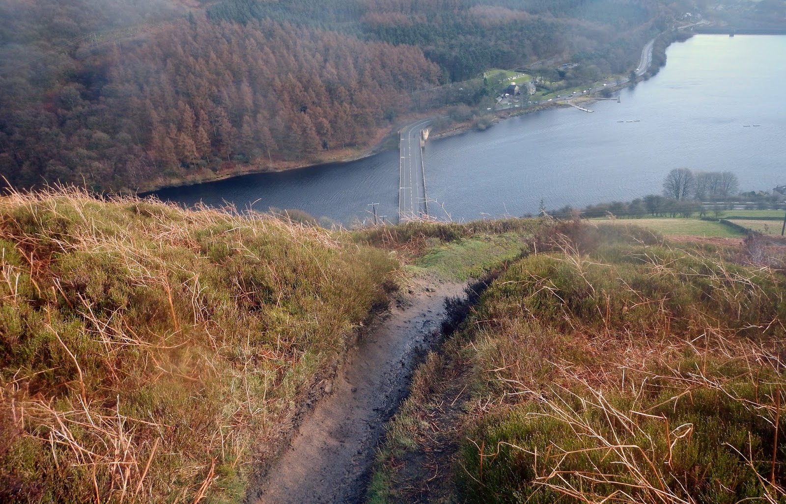
I really can't recommend my current training strategy. I have done virtually no training for Beachy Head later this month. In this case, virtually no training is not a failure to prepare, it is a considered and deliberate strategy. Three months ago the consultant I saw recommended me for knee arthroscopy and put me back in the care of the National Health Service. Since that time there has been no communication from anybody. I had asked the consultant I if it was safe to do any running. He answered that if there was no pain, I was not doing any harm.
No pain, no harm sounded encouraging, except that I found I could do little without pain. Eventually I was able to run a little, then after a couple of weeks the pain returned. After much rest I can now run a little again, I don't push it. By some quirk of mechanics I have found that even when I feel pain on normal walking, I am often OK striding purposefully. A plan began to form, the time
limit for Beachy Head Marathon is a generous nine hours.
Looking north from Macclesfield Forest, Tegg's Nose on the right.
I felt that I
could probably walk fast enough to complete a marathon in nine hours,
though it is more than twenty years since I did any serious walking. As I had a bit of time off last week, I thought I had better see if I my walking bits still worked. A twenty, a ten then another twenty mile walk caused no problems at all. I did the twenties in six hours, without making any effort, including leisurely sandwich stops and some tricky path finding. Unlike when running, my finishing pace is considerably quicker than my starting pace. I should be able to walk Beachy Head in around seven hours (provided I finish at all), I will run some if I can. I am keeping my running to the
bare minimum, just a bit of jogging to keep fit really. I did allow
myself seven miles round Macc. Forest and over Shutlingsloe last week.
It was fantastic to be on the fells again after a five month absence, I
was almost in tears.
Thursday, 2 October 2014
Friday, 25 July 2014
Because I can.
When anyone asks me why I run, and a short reply is expected, I always answer "because I can". I have always enjoyed my runs, except maybe for some of those short runs fitted around work that just keep one fit for the real running. Watch a dog tearing about and woofing for the sheer joy of being free and you will understand what I mean.
I saw the consultant again after my MRI scans, the scans confirmed his (and the Nuffield physio's) initial diagnosis. I have tears to the medial meniscus of my left knee. Unfortunately this will require surgery to sort out. I do feel some relief in knowing that this diagnosis is demonstrably correct.
I spent £60 on the Nuffield physio appointment, £200 on the consultation and £300 on the MRI in the belief that the previous physio and my GP had failed me. Money well spent as it turns out, even if I should not have had to spend it. The consultant is referring me back to the National Health Service in the hope of saving me the £3020 fee for the knee arthroscopy. He is of the opinion that the wait should not be too long, as he will emphasize that I had the injury for some time (between 18 and 24 months) before it was diagnosed . Either way it will be he who performs the procedure.
If I do not get an appointment fairly soon I will probably find the money. Three grand is a vast sum to me, but I cannot think of many things that would improve my quality of life more than an early return to the fells. I am also looking forward to being able to eat as much as I want with impunity. I have had to moderate my food intake much more than expected to keep my weight constant.
Getting it right
I missed a lot of running due to my injury, last year. I have missed even more, so far, this year. Whether it was three months abstinence, the fact that I am older and appreciate stuff more or the careful long run planning, I don't know, but I have enjoyed what running I have done this year more than ever. One only has to read the relevant blog entries to know that this is not a rose tinted retrospective view.
I saw the consultant again after my MRI scans, the scans confirmed his (and the Nuffield physio's) initial diagnosis. I have tears to the medial meniscus of my left knee. Unfortunately this will require surgery to sort out. I do feel some relief in knowing that this diagnosis is demonstrably correct.
I spent £60 on the Nuffield physio appointment, £200 on the consultation and £300 on the MRI in the belief that the previous physio and my GP had failed me. Money well spent as it turns out, even if I should not have had to spend it. The consultant is referring me back to the National Health Service in the hope of saving me the £3020 fee for the knee arthroscopy. He is of the opinion that the wait should not be too long, as he will emphasize that I had the injury for some time (between 18 and 24 months) before it was diagnosed . Either way it will be he who performs the procedure.
If I do not get an appointment fairly soon I will probably find the money. Three grand is a vast sum to me, but I cannot think of many things that would improve my quality of life more than an early return to the fells. I am also looking forward to being able to eat as much as I want with impunity. I have had to moderate my food intake much more than expected to keep my weight constant.
Getting it right
I missed a lot of running due to my injury, last year. I have missed even more, so far, this year. Whether it was three months abstinence, the fact that I am older and appreciate stuff more or the careful long run planning, I don't know, but I have enjoyed what running I have done this year more than ever. One only has to read the relevant blog entries to know that this is not a rose tinted retrospective view.
Thursday, 26 June 2014
It's all uphill
"I wish I were as cocksure of anything as Tom Macaulay is of everything." -
William Lamb, 2nd Viscount Melbourne.
Here we are, well into June and I am still not back on the hills1. At least some fairly lightweight walking is now possible, I've even had the odd canter for a few hundred metres on straightforward paths. As my GP wasn't going to refer me further (and my attempts to change practice have been fruitless so far*), I decided on finding another physiotherapist. The aim here was to find a physio' that could refer me on if necessary. This has meant making a commitment to pursuing general private health care on a 'pay as you go basis', not a decision I was too sure about.
The Nuffield physiotherapist questioned me thoroughly then did a thing called "an examination", GPs might consider adopting this practise. She told me that physiotherapy was not going to help me and referred me to a consultant. Her diagnosis was that the problem was a 'healed' cartilage injury, probably the one I sustained about eighteen months ago, and other injuries due to compensation. It was for this kind of candid appraisal that I chose an integrated health service. Call me cynical, but I believe it less likely that a 'stand alone' physio' would admit that they couldn't help (and I have the bills to substantiate this belief). She thought it likely that surgery could help.
Managing the odd five miles of walking if I take it steady - Shacklow Bone Mill on the River Wye.
My appointment with the consultant was on the 24th. He examined me, concurred with the physio's diagnosis then sent me for an MRI that afternoon to confirm that surgery is warranted. At the end of the MRI scan I was given a disc to take back to the consultant.
At all times, my experience has been of a punctual, competent, efficient, polite and generally well run service. This impressed me, what impressed me more was that resources were sufficient for the job, but no money had been wasted on that which would be superfluous. The last point was particularly important to one who was spending more money in a day than at any other time in his life, except when a car had needed replacing.
My next appointment with the consultant is on the first of July. There are only two possible outcomes from this meeting, I learn that surgery is not going to be beneficial or that surgery might be beneficial. If surgery will help, I will have to decide whether I am prepared to spend the major portion of my life savings to be able to run again. For once I am pretty sure about something - wouldn't you be?
1 For first time readers - Pain in my left knee is preventing me from running, my GP has told me that my varicose veins are the culprit.
*It may be possible for me to change from the worst surgery in the area to the second worst. Moving house to get into the catchment area of one of the better surgeries would be much more expensive than paying for my own op' (though would have benefits in the long run).
Here we are, well into June and I am still not back on the hills1. At least some fairly lightweight walking is now possible, I've even had the odd canter for a few hundred metres on straightforward paths. As my GP wasn't going to refer me further (and my attempts to change practice have been fruitless so far*), I decided on finding another physiotherapist. The aim here was to find a physio' that could refer me on if necessary. This has meant making a commitment to pursuing general private health care on a 'pay as you go basis', not a decision I was too sure about.
The Nuffield physiotherapist questioned me thoroughly then did a thing called "an examination", GPs might consider adopting this practise. She told me that physiotherapy was not going to help me and referred me to a consultant. Her diagnosis was that the problem was a 'healed' cartilage injury, probably the one I sustained about eighteen months ago, and other injuries due to compensation. It was for this kind of candid appraisal that I chose an integrated health service. Call me cynical, but I believe it less likely that a 'stand alone' physio' would admit that they couldn't help (and I have the bills to substantiate this belief). She thought it likely that surgery could help.
Managing the odd five miles of walking if I take it steady - Shacklow Bone Mill on the River Wye.
My appointment with the consultant was on the 24th. He examined me, concurred with the physio's diagnosis then sent me for an MRI that afternoon to confirm that surgery is warranted. At the end of the MRI scan I was given a disc to take back to the consultant.
At all times, my experience has been of a punctual, competent, efficient, polite and generally well run service. This impressed me, what impressed me more was that resources were sufficient for the job, but no money had been wasted on that which would be superfluous. The last point was particularly important to one who was spending more money in a day than at any other time in his life, except when a car had needed replacing.
My next appointment with the consultant is on the first of July. There are only two possible outcomes from this meeting, I learn that surgery is not going to be beneficial or that surgery might be beneficial. If surgery will help, I will have to decide whether I am prepared to spend the major portion of my life savings to be able to run again. For once I am pretty sure about something - wouldn't you be?
1 For first time readers - Pain in my left knee is preventing me from running, my GP has told me that my varicose veins are the culprit.
*It may be possible for me to change from the worst surgery in the area to the second worst. Moving house to get into the catchment area of one of the better surgeries would be much more expensive than paying for my own op' (though would have benefits in the long run).
Thursday, 22 May 2014
May and still still after six weeks
I'm pretty much speechless with frustration. I am still not able to resume training. Everything was going well, I was fitter than ever, 20 to 28 miles over the hills at an easy pace had become entirely comfortable, then suddenly I'm a non runner again. I felt a little better a couple of weeks ago so tried an exploratory run of around five and a half miles. My left knee hurt a little at the time and a couple of days later was the worst it has been. This weekend, a few hundred metres was enough to cause searing pain.
I ran just over 250 miles between the end of February and the beginning of April. I developed my injury on the second of two back to back weekends of 26 +10 miles. There was no real warning, I just started to feel knee pain at the beginning of the second 26, it eased and I ran the +10 without too much trouble. The pain developed during the following rest day. After an easy week I ran the 6.5 mile Mow Cop Race, which hurt toward the end. Since then I have only run the trial runs described above. I am in a worse state after six weeks rest than when I started.
I have managed to get out and walk some of my local area which has allowed me to do some litter picking in Apedale. When the pain is at its worst even walking is out. It is particularly frustrating not to be out at this time of year while nature is so beautiful and eventful.
A clearing on my home route, the Hawthorn is also wonderful this year and the first roses are now in bloom.
Recommencement of mining at Bignall
I have managed to find out little concerning the progress of the application for the recommencement of mining on Bignall/Old Hill that I mentioned back in March. As far as I am aware the planning application is still being considered by Staffordshire County Council. The official name of the proposed development is Great Oak, though this name refers to an area further west than the proposed development. Links to documents can be found at UK Coal and Staffs CC. There is an action group Facebook page here.
Below is a bit of an Old Hill gallery in case the real thing is dug up.
I ran just over 250 miles between the end of February and the beginning of April. I developed my injury on the second of two back to back weekends of 26 +10 miles. There was no real warning, I just started to feel knee pain at the beginning of the second 26, it eased and I ran the +10 without too much trouble. The pain developed during the following rest day. After an easy week I ran the 6.5 mile Mow Cop Race, which hurt toward the end. Since then I have only run the trial runs described above. I am in a worse state after six weeks rest than when I started.
I have managed to get out and walk some of my local area which has allowed me to do some litter picking in Apedale. When the pain is at its worst even walking is out. It is particularly frustrating not to be out at this time of year while nature is so beautiful and eventful.
A clearing on my home route, the Hawthorn is also wonderful this year and the first roses are now in bloom.
Recommencement of mining at Bignall
I have managed to find out little concerning the progress of the application for the recommencement of mining on Bignall/Old Hill that I mentioned back in March. As far as I am aware the planning application is still being considered by Staffordshire County Council. The official name of the proposed development is Great Oak, though this name refers to an area further west than the proposed development. Links to documents can be found at UK Coal and Staffs CC. There is an action group Facebook page here.
Below is a bit of an Old Hill gallery in case the real thing is dug up.
Tuesday, 8 April 2014
Mow Cop Hill Race 6.5 miles BM 06/04/14
Summer time again. The clock change meant a couple of things in the coming week, no need for a head torch in the evening and Mow Cop Hill Race. This year I was able to plan
my training schedule a little better and so avoid running 26 miles the
day before Mow Cop. Not that everything went smoothly this year.
I seem to have developed a knee injury in addition to my long standing one. The knee started to hurt at the beginning of last weekend's long run, an unexceptional tour of local footpaths. It didn't seem any worse 26 miles later so I did my usual 10 miles the next day. It stiffened up at work so I rested most of the week, though I did 8 miles on Wednesday. The knee was still hurting on Sunday morning, but as it seemed to ease up with movement I decided to run.
The weather forecast for the race was not at all good, an 80% chance of heavy rain. This on top of a few days of rain and a very wet winter, it was going to be muddy. The usual field used for parking was not available as it was too soggy. Consequently, there was a big squeeze into the Village Hall car park, managed excellently by the hard working marshals. This did have the benefit that the beautiful horses who occupy the field above the normal parking field could be seen playing on the skyline.
Horses frolicking on the skyline, bit blurry I am afraid as this was something of a long shot.
Despite the forecast there was a good turn out and to reward us the weather was, so far, dry. I had a good warm up run to unseize my knee. Ambient temperature was surprisingly high and I decided to ditch my long sleeve top before the start.
At the start, a good turn out despite the poor weather forecast.
I noticed that, like myself, just about everyone had chosen minimalist fell shoes despite the significant amount of road and hard packed trail. After the usual talk we were off. I made a reasonably quick start trying to make a compromise between wasting effort speeding to a halt at the first stile and not arriving so late that the queue was excessively long. I was already very glad that I had ditched the long sleeve top.
Queuing for the first stile. The bum bags suggest that I am not the only one who decided to carry a waterproof.
As the field opened out I spotted a few familiar runners, Debbie Hill was just ahead. I usually finish fairly close to, but behind, Debbie, who I know only from result lists. We were soon in the quarry where I anticipated a bottleneck that would allow another photograph.
Mow Cop Quarry, Debbie Hill (nearest) and Charmaine Wood in the Congleton Harriers tops.
Also anticipated was that the Gritstone Trail through the trees near Roepark Farm would be slippery, and that the subsequent usually boggy field would be more than usually boggy. There was no disappointment in either of these respects. I overtook Debbie Hill somewhere in the boggy field, where at least one participant stopped to replace a shoe (at least he recovered it). I expected Debbie would re pass me when the going firmed up.
I ran on my own for a while, though I could see a couple of runners some way ahead. I measured my pace and reckoned I was capable of a bit more effort. I gradually closed the gap across grass and on the slippery downhill stream side path. There really is some good and varied scenery in just 6.5 miles. By the time we reached the first bend in the road I was only a few paces behind a runner in a Congleton Harriers top (Bib 54, Charmaine Wood). As the road levelled I found it hard to keep up, but stuck with her.
When we hit the dirt again I started to gain on the runner ahead and as the gradient steepened I went past her. I felt unusually strong on the steep climb where the South Cheshire Way turns up through Quarry Wood, I'll swear it was shorter this year.
I managed to stay strong to the finish and I dare say I could have shaved off ten or more seconds in the final descent if I was less of a scaredy-cat.
I finished shortly before Charmaine, I shook her hand and told her how much fun it had been to chase her. I also managed to stay ahead of Debbie, for a change. I shook her hand too and explained that I knew her by sight and pace.
I finished in 01:05:13. I'm happy enough with that in this year's conditions, and pleased with how I coped with the filth (all those evening, muddy tree roots by torchlight must have helped). Special congratulations to Olivia Walwyn of Altrincham AC who came in 7th overall and first lady at 00:50:59 (which I am pretty sure is a clear course record). Full results are at Mow Cop Runners. It never did rain.
The knee had hurt in the last mile, was OK later in the day, was a bit stiff on Monday, ..Tuesday morning and it hurts like rest.
Thanks to Mow Cop Runners for organising this event, it's always fun. I don't know what kind of arrangement they had to make to keep the rain off. Whatever it was, we are all very grateful.
I seem to have developed a knee injury in addition to my long standing one. The knee started to hurt at the beginning of last weekend's long run, an unexceptional tour of local footpaths. It didn't seem any worse 26 miles later so I did my usual 10 miles the next day. It stiffened up at work so I rested most of the week, though I did 8 miles on Wednesday. The knee was still hurting on Sunday morning, but as it seemed to ease up with movement I decided to run.
The weather forecast for the race was not at all good, an 80% chance of heavy rain. This on top of a few days of rain and a very wet winter, it was going to be muddy. The usual field used for parking was not available as it was too soggy. Consequently, there was a big squeeze into the Village Hall car park, managed excellently by the hard working marshals. This did have the benefit that the beautiful horses who occupy the field above the normal parking field could be seen playing on the skyline.
Horses frolicking on the skyline, bit blurry I am afraid as this was something of a long shot.
Despite the forecast there was a good turn out and to reward us the weather was, so far, dry. I had a good warm up run to unseize my knee. Ambient temperature was surprisingly high and I decided to ditch my long sleeve top before the start.
At the start, a good turn out despite the poor weather forecast.
I noticed that, like myself, just about everyone had chosen minimalist fell shoes despite the significant amount of road and hard packed trail. After the usual talk we were off. I made a reasonably quick start trying to make a compromise between wasting effort speeding to a halt at the first stile and not arriving so late that the queue was excessively long. I was already very glad that I had ditched the long sleeve top.
Queuing for the first stile. The bum bags suggest that I am not the only one who decided to carry a waterproof.
As the field opened out I spotted a few familiar runners, Debbie Hill was just ahead. I usually finish fairly close to, but behind, Debbie, who I know only from result lists. We were soon in the quarry where I anticipated a bottleneck that would allow another photograph.
Mow Cop Quarry, Debbie Hill (nearest) and Charmaine Wood in the Congleton Harriers tops.
Also anticipated was that the Gritstone Trail through the trees near Roepark Farm would be slippery, and that the subsequent usually boggy field would be more than usually boggy. There was no disappointment in either of these respects. I overtook Debbie Hill somewhere in the boggy field, where at least one participant stopped to replace a shoe (at least he recovered it). I expected Debbie would re pass me when the going firmed up.
I ran on my own for a while, though I could see a couple of runners some way ahead. I measured my pace and reckoned I was capable of a bit more effort. I gradually closed the gap across grass and on the slippery downhill stream side path. There really is some good and varied scenery in just 6.5 miles. By the time we reached the first bend in the road I was only a few paces behind a runner in a Congleton Harriers top (Bib 54, Charmaine Wood). As the road levelled I found it hard to keep up, but stuck with her.
When we hit the dirt again I started to gain on the runner ahead and as the gradient steepened I went past her. I felt unusually strong on the steep climb where the South Cheshire Way turns up through Quarry Wood, I'll swear it was shorter this year.
I managed to stay strong to the finish and I dare say I could have shaved off ten or more seconds in the final descent if I was less of a scaredy-cat.
I finished shortly before Charmaine, I shook her hand and told her how much fun it had been to chase her. I also managed to stay ahead of Debbie, for a change. I shook her hand too and explained that I knew her by sight and pace.
I finished in 01:05:13. I'm happy enough with that in this year's conditions, and pleased with how I coped with the filth (all those evening, muddy tree roots by torchlight must have helped). Special congratulations to Olivia Walwyn of Altrincham AC who came in 7th overall and first lady at 00:50:59 (which I am pretty sure is a clear course record). Full results are at Mow Cop Runners. It never did rain.
The knee had hurt in the last mile, was OK later in the day, was a bit stiff on Monday, ..Tuesday morning and it hurts like rest.
Thanks to Mow Cop Runners for organising this event, it's always fun. I don't know what kind of arrangement they had to make to keep the rain off. Whatever it was, we are all very grateful.
Wednesday, 26 March 2014
Ladybower's eastern side.
A very varied jaunt of around 26 miles and 4700'+ of ascent. Started from Cutthroat bridge and taking in Bradfield Dale, Broomhead Moor, Ewden Beck, Stirling wreck, Derwent and Bamford Edges.
The forecast for Saturday was not good, starting bright, but then showers some heavy and brisk winds. As it turned out things were quite a lot worse than anticipated. While not needing any of the extra gear I always insist on lugging around, I would have felt foolish and vulnerable had I not been carrying it.
I started on the Moscar path towards Strines Reservoir, this was pleasantly green, and I soon met the minor road which I would follow until leaving on the path past Sugworth Hall. As tarmac sections go this was not bad at all, lovely views and a verge good enough to run on.
There's tarmac and there's tarmac. Minor road on the way to Sugworth Hall, Boot's tower lit by the sun.
The footpath, part of Sheffield Country Walk, goes through a 'tradesmen's entrance' to the side of the main gate to Sugworth Hall. The main driveway is then followed before scuttling right into ancient rhododendrons. The well maintained path wriggles delightfully through the tangled shrubs. Almost as soon as one's eyes have become accustomed to the shade, they are dazzled by the light streaming through the arch that forms the exit.
Footpath through the rhododendrons skirting Sugworth Hall.
As the eyes become re accustomed to daylight one can make out Boot's Tower framed in the arch (unfortunately not visible in the photo above as I neglected to use HDR mode).
The path passes within a hundred metres of the tower shortly, access is permitted though I was unaware of this at the time.
Boot's Tower aka Boot's Folly aka Sugworth etc., etc.
It was a real pleasure to cross this open ground, a nice grassy path firm under foot, great views all round and the weather still holding. The path starts downhill and then swings north east, approaching Strines Reservoir near its dam then following Dale Dike Reservoir. March 2014 marks the 150th anniversary of the collapse of Dale Dike Dam and the event is commemorated in Bradfield.
There is a choice of paths here, a lower path right on the reservoir's shore and a higher parallel path. I followed the higher path as I thought the views would be better (though it meant more tarmac later), I was not disappointed the views were superb.
Superb views of gentle countryside from Sheffield Country Walk path, Bradfield Dale.
The path swings up through woods to Blindside Lane, I followed the tarmac lane the couple of kilometres to Low Bradfield, there was plenty of interest. Low Bradfield is quite lovely, a model village. So much scenery behind me and only five miles into my run. I ate a bun and had a good swig of cola.
Navigation now became a little trickier than I had anticipated. My printer had failed to reproduce a rather important two centimetres of map. I had not worried unduly as I just had to follow the edge of Agden Reservoir, unfortunately it was not visible from the road in. In fact this reservoir turned out to be rather well hidden, for such a large mass of water, until one was a stones throw away.
I set off in the right general direction (north) and soon passed a Smallfield Lane, this was promising as Smallfield was the next visible thing on my map. However a rather beautiful village, hanging in the hillside above me, caught my eye and I determined to take it in. This village is High Bradfield, one of the most charming villages I have ever had the fortune to visit. The photograph below gives a taste I hope. This is somewhere I look forward to revisiting when I have time for lunch and a pint.
The charming village of High Bradfield, hung high on the hillside (and visited by Sheffield Country Walk).
I left High Bradfield, with some regret and turned back for Smallfield Lane. There followed around two and a half kilometres of tarmac before swinging east across the moors on Dukes Road (path). I had checked this section of tarmac on Google Street View and it looked pretty enough, it did not disappoint.
Dukes Road would be very difficult to miss. No sooner are you on this bridleway, at first wide and well made, than the gentle views give way to bleak moorland. Looking behind me I could see the industrial cities of South Yorkshire, ahead was the High Peak, slightly left (south west) an ominous darkness was gathering. As this was the direction of the wind, I elected to get into my waterproof while I was still dry. This turned out to be a good call, by the time I had unrolled the jacket and got into it the rain was upon me, light at first, hail soon followed. There was enough wind for the hail to hurt.
I ran on until I crossed Rushy Dike. I intended to leave Dukes Road where it turns south west, however I was not sure whether the turn was clear enough to be easily noticeable. Consequently I decided to keep my eye on the time, after crossing Rushy Dike, as there was little else to navigate by. When the the bend came, it was pretty noticeable on the ground.
I left the path to head northish over the open moor, following the compass as there really was nothing to see. I was aiming just east of grid north. I wanted to meet Ewden Beck near where it is joined by Oaken Clough, it made sense to aim off to the east and follow Ewden Beck west. Eventually I saw the shooting lodge to my right and the tree lined valley ahead. I was pretty much bang on target which really had a lot to do with luck as I had had to follow groughs and detour round bog.
The valley floor, wonders both natural and unnatural.
I made my way down the valley side, indirectly, but safely. This valley is the stuff that fairy tales are made of. Everywhere was soft green and mossy, the river tumbled between boulders while rowan and birch looked kindly on. Even the weather relented as if to smile on this magical place. It would be hard to imagine more of a contrast than between this scene and the bleak moorland I had just left. I reached the valley floor at the junction with Oaken Clough. I paused to get some photos of the stream, out of the top corner of my right eye I spotted something that was not of natural origin.
This was part of the wreckage of Short Sterling LJ628, fuselage ribs probably. LJ628 crashed onto the moor on 21st July 1944 and despite the plane being smashed to pieces all ten of the crew survived, eight of the ten walked out! I had not expected to see wreckage here as I was some way from the crash site. I was also surprised that these pieces were so large, I thought all significant stuff had been taken by the Stirling Aircraft Project in 2005.
Close up of the debris seen at top right of the photo above.
Part of an aerofoil and control surface (and dead sheep for scale and atmosphere).
As I followed the beck I saw more large pieces of the aircraft including a section of aerofoil and pivoted control surfaces. I had heard that some pieces of wreckage had been spotted remote from the crash site (at an unreported location). Maybe they have been carried here then abandoned or maybe they were blown here when they still had significant amounts of sheet metal attached to catch the wind.
A tranquil, magical place.
I followed Stainery Clough out, the wooded valley soon gave way to open moorland again. As if to emphasise the change in scenery, the hail re started with a vengeance. Visibility became quite poor and the wind became bitter. It was time for a bite to eat, but it was too wet and cold to stop and fuss. I determined to make my way back onto the main route.
I set off on a bearing again, I had expected to run a bearing notwithstanding the weather, there would have been little to see had the visibility been better. The aim was to meet the path some way after I had left it, but before the Howden Edge/Cartledge Stones Ridge fork. I had enjoyed the path above Abbey Brook last time I was here and was determined to see more of it rather than take the shorter ridge path to Back Tor. Several mountain hares later I dropped onto the path exactly where planned, a lot of luck must have been involved as I was drifting too far east every time I checked my bearing. Somehow my guestimated course corrections seem to have worked out about right.
The narrow path high above Abbey Brook is pretty special, it is also pretty scary. The hail had beaten up a fair muddy covering on the path, I took it steady. There were gaps in the hail that allowed the odd snap, though I had nothing left that was dry enough to wipe the lens cover glass by now.
Path high above Abbey Brook, a break in the hail before turning south. One wouldn't want to slip here.
The exhilaration of the Abbey Brook path over, it was time to swing back south along the track following Sheepfold Clough and on to Lost Lad, Back Tor and then follow the Derwent Edge path back down the reservoir. The hail came hard for most of the run back, I found some shelter behind a boulder to get a bun and swap my cola bottle for a full one.
Eerie lighting, glimpses of a view through clearings in the cloud, sometimes I would see cloud below me over the reservoir.
I had the option of including a planned loop taking in Bamford Edge or heading back to Cutthroat bridge. Despite the weather I was feeling OK and was well up for another six miles or so. Shortly before the descent from Derwent Edge the weather relented as if to encourage me in my endeavour. I took the 'straight off the end' path this time, an unlikely and fairly direct route to join the road for Bamford.
An unlikely looking descent.
I crossed Ladybower on the A6103 then took the footpath down to the Derwent and Yorkshire Bridge. Here I picked up the bridleway to take the Long Tour of Bradwell route to the crossing at Bamford Mills and on up to New Road. As I left New Road and started up for Bamford Edge the weather started to close in again. I quickly took the photo below thinking that it might be the only one I would get of the Edge. As can be seen, wiping the cover glass was still a problem.
I thought this might be the day's one and only photo of Bamford Edge as the weather closed in.
It was not long before the wind and hail reached a ferocious pitch, the hail was in my face and really painful. I pulled my buff right up and well over my nose so that it was just under my specs. Somewhat surprisingly this actually stopped my specs steaming up, this had been a significant problem when I zipped my jacket right up.
I started to feel the cold a bit, feeling in my fingertips had been something of a variable commodity for some hours, but in general I had stayed warm enough. Now the cold started to be a bit threatening, I was glad I had eaten again at Yorkshire Bridge. As I was still feeling fine I picked up my speed a little to keep warm. I took in my surroundings, felt the weather increase its efforts, chuckled a little and thought to myself, "this is where I want to be", as long as my feet don't hurt I'm good.
Bamford Edge, the hail was starting to settle quite well.
Despite the fact that I was still enjoying myself, the threatening cold made me glad to be near the end of my run. I took a few more pictures figuring that they would illustrate how bad the weather was if nothing else.
As I turned east towards Cutthroat Bridge the hail eased a little and for the first time I could see, in the distance, just how much had settled where conditions were favourable.
It did not take long to cover the remaining distance to the car, improving visibility meant that I could navigate by sight. I planned an optimum sequence of unlocking car doors, removing and replacing clothing, setting of the blowers and eating buns, while I ran. I was that cold.
Hail settling like snow in the distance.
My last bun on the inside and fibre pile on the outside I set off for Bradwell where I intended a serious raid on the Co-op. I had not warmed up fully and my teeth began to chatter as I shopped. The cashier, kindly, asked if I was OK. I explained that I had been running and would be fine once I had eaten the armfuls of food I had swept up. Another customer said that he was running a marathon, Manchester, for the first time and had just completed his last long training run. I wished him the best then set about my feast in the car park, there were no chipotle wraps this time (the falafel ones are not bad).
Another cracking run* in the Peak District. This one really had it in variety of both scenery and terrain. I must visit Ewden Beck again and the Bradfields, I also want to do even more of the Abbey Brook path.
Given the weather I was pretty comfortable and I am happy with my present gear choices. I was particularly pleased with my Montane Minimus waterproof jacket.
Sunday's ten miles at home went smoothly, I was lucky with a weather window. Old Hill looked particularly fine, the thought of it being torn up by bulldozers choked me.
*Run/walk to be accurate, the Ewden Beck section was not runnable.
The forecast for Saturday was not good, starting bright, but then showers some heavy and brisk winds. As it turned out things were quite a lot worse than anticipated. While not needing any of the extra gear I always insist on lugging around, I would have felt foolish and vulnerable had I not been carrying it.
I started on the Moscar path towards Strines Reservoir, this was pleasantly green, and I soon met the minor road which I would follow until leaving on the path past Sugworth Hall. As tarmac sections go this was not bad at all, lovely views and a verge good enough to run on.
There's tarmac and there's tarmac. Minor road on the way to Sugworth Hall, Boot's tower lit by the sun.
The footpath, part of Sheffield Country Walk, goes through a 'tradesmen's entrance' to the side of the main gate to Sugworth Hall. The main driveway is then followed before scuttling right into ancient rhododendrons. The well maintained path wriggles delightfully through the tangled shrubs. Almost as soon as one's eyes have become accustomed to the shade, they are dazzled by the light streaming through the arch that forms the exit.
Footpath through the rhododendrons skirting Sugworth Hall.
As the eyes become re accustomed to daylight one can make out Boot's Tower framed in the arch (unfortunately not visible in the photo above as I neglected to use HDR mode).
The path passes within a hundred metres of the tower shortly, access is permitted though I was unaware of this at the time.
Boot's Tower aka Boot's Folly aka Sugworth etc., etc.
It was a real pleasure to cross this open ground, a nice grassy path firm under foot, great views all round and the weather still holding. The path starts downhill and then swings north east, approaching Strines Reservoir near its dam then following Dale Dike Reservoir. March 2014 marks the 150th anniversary of the collapse of Dale Dike Dam and the event is commemorated in Bradfield.
There is a choice of paths here, a lower path right on the reservoir's shore and a higher parallel path. I followed the higher path as I thought the views would be better (though it meant more tarmac later), I was not disappointed the views were superb.
The path swings up through woods to Blindside Lane, I followed the tarmac lane the couple of kilometres to Low Bradfield, there was plenty of interest. Low Bradfield is quite lovely, a model village. So much scenery behind me and only five miles into my run. I ate a bun and had a good swig of cola.
Navigation now became a little trickier than I had anticipated. My printer had failed to reproduce a rather important two centimetres of map. I had not worried unduly as I just had to follow the edge of Agden Reservoir, unfortunately it was not visible from the road in. In fact this reservoir turned out to be rather well hidden, for such a large mass of water, until one was a stones throw away.
I set off in the right general direction (north) and soon passed a Smallfield Lane, this was promising as Smallfield was the next visible thing on my map. However a rather beautiful village, hanging in the hillside above me, caught my eye and I determined to take it in. This village is High Bradfield, one of the most charming villages I have ever had the fortune to visit. The photograph below gives a taste I hope. This is somewhere I look forward to revisiting when I have time for lunch and a pint.
The charming village of High Bradfield, hung high on the hillside (and visited by Sheffield Country Walk).
I left High Bradfield, with some regret and turned back for Smallfield Lane. There followed around two and a half kilometres of tarmac before swinging east across the moors on Dukes Road (path). I had checked this section of tarmac on Google Street View and it looked pretty enough, it did not disappoint.
Dukes Road would be very difficult to miss. No sooner are you on this bridleway, at first wide and well made, than the gentle views give way to bleak moorland. Looking behind me I could see the industrial cities of South Yorkshire, ahead was the High Peak, slightly left (south west) an ominous darkness was gathering. As this was the direction of the wind, I elected to get into my waterproof while I was still dry. This turned out to be a good call, by the time I had unrolled the jacket and got into it the rain was upon me, light at first, hail soon followed. There was enough wind for the hail to hurt.
I ran on until I crossed Rushy Dike. I intended to leave Dukes Road where it turns south west, however I was not sure whether the turn was clear enough to be easily noticeable. Consequently I decided to keep my eye on the time, after crossing Rushy Dike, as there was little else to navigate by. When the the bend came, it was pretty noticeable on the ground.
I left the path to head northish over the open moor, following the compass as there really was nothing to see. I was aiming just east of grid north. I wanted to meet Ewden Beck near where it is joined by Oaken Clough, it made sense to aim off to the east and follow Ewden Beck west. Eventually I saw the shooting lodge to my right and the tree lined valley ahead. I was pretty much bang on target which really had a lot to do with luck as I had had to follow groughs and detour round bog.
The valley floor, wonders both natural and unnatural.
I made my way down the valley side, indirectly, but safely. This valley is the stuff that fairy tales are made of. Everywhere was soft green and mossy, the river tumbled between boulders while rowan and birch looked kindly on. Even the weather relented as if to smile on this magical place. It would be hard to imagine more of a contrast than between this scene and the bleak moorland I had just left. I reached the valley floor at the junction with Oaken Clough. I paused to get some photos of the stream, out of the top corner of my right eye I spotted something that was not of natural origin.
This was part of the wreckage of Short Sterling LJ628, fuselage ribs probably. LJ628 crashed onto the moor on 21st July 1944 and despite the plane being smashed to pieces all ten of the crew survived, eight of the ten walked out! I had not expected to see wreckage here as I was some way from the crash site. I was also surprised that these pieces were so large, I thought all significant stuff had been taken by the Stirling Aircraft Project in 2005.
Close up of the debris seen at top right of the photo above.
Another aluminium rib.
Part of an aerofoil and control surface (and dead sheep for scale and atmosphere).
As I followed the beck I saw more large pieces of the aircraft including a section of aerofoil and pivoted control surfaces. I had heard that some pieces of wreckage had been spotted remote from the crash site (at an unreported location). Maybe they have been carried here then abandoned or maybe they were blown here when they still had significant amounts of sheet metal attached to catch the wind.
A tranquil, magical place.
I followed Stainery Clough out, the wooded valley soon gave way to open moorland again. As if to emphasise the change in scenery, the hail re started with a vengeance. Visibility became quite poor and the wind became bitter. It was time for a bite to eat, but it was too wet and cold to stop and fuss. I determined to make my way back onto the main route.
I set off on a bearing again, I had expected to run a bearing notwithstanding the weather, there would have been little to see had the visibility been better. The aim was to meet the path some way after I had left it, but before the Howden Edge/Cartledge Stones Ridge fork. I had enjoyed the path above Abbey Brook last time I was here and was determined to see more of it rather than take the shorter ridge path to Back Tor. Several mountain hares later I dropped onto the path exactly where planned, a lot of luck must have been involved as I was drifting too far east every time I checked my bearing. Somehow my guestimated course corrections seem to have worked out about right.
The narrow path high above Abbey Brook is pretty special, it is also pretty scary. The hail had beaten up a fair muddy covering on the path, I took it steady. There were gaps in the hail that allowed the odd snap, though I had nothing left that was dry enough to wipe the lens cover glass by now.
Path high above Abbey Brook, a break in the hail before turning south. One wouldn't want to slip here.
The exhilaration of the Abbey Brook path over, it was time to swing back south along the track following Sheepfold Clough and on to Lost Lad, Back Tor and then follow the Derwent Edge path back down the reservoir. The hail came hard for most of the run back, I found some shelter behind a boulder to get a bun and swap my cola bottle for a full one.
Eerie lighting, glimpses of a view through clearings in the cloud, sometimes I would see cloud below me over the reservoir.
I had the option of including a planned loop taking in Bamford Edge or heading back to Cutthroat bridge. Despite the weather I was feeling OK and was well up for another six miles or so. Shortly before the descent from Derwent Edge the weather relented as if to encourage me in my endeavour. I took the 'straight off the end' path this time, an unlikely and fairly direct route to join the road for Bamford.
An unlikely looking descent.
I crossed Ladybower on the A6103 then took the footpath down to the Derwent and Yorkshire Bridge. Here I picked up the bridleway to take the Long Tour of Bradwell route to the crossing at Bamford Mills and on up to New Road. As I left New Road and started up for Bamford Edge the weather started to close in again. I quickly took the photo below thinking that it might be the only one I would get of the Edge. As can be seen, wiping the cover glass was still a problem.
I thought this might be the day's one and only photo of Bamford Edge as the weather closed in.
It was not long before the wind and hail reached a ferocious pitch, the hail was in my face and really painful. I pulled my buff right up and well over my nose so that it was just under my specs. Somewhat surprisingly this actually stopped my specs steaming up, this had been a significant problem when I zipped my jacket right up.
I started to feel the cold a bit, feeling in my fingertips had been something of a variable commodity for some hours, but in general I had stayed warm enough. Now the cold started to be a bit threatening, I was glad I had eaten again at Yorkshire Bridge. As I was still feeling fine I picked up my speed a little to keep warm. I took in my surroundings, felt the weather increase its efforts, chuckled a little and thought to myself, "this is where I want to be", as long as my feet don't hurt I'm good.
Bamford Edge, the hail was starting to settle quite well.
Despite the fact that I was still enjoying myself, the threatening cold made me glad to be near the end of my run. I took a few more pictures figuring that they would illustrate how bad the weather was if nothing else.
As I turned east towards Cutthroat Bridge the hail eased a little and for the first time I could see, in the distance, just how much had settled where conditions were favourable.
It did not take long to cover the remaining distance to the car, improving visibility meant that I could navigate by sight. I planned an optimum sequence of unlocking car doors, removing and replacing clothing, setting of the blowers and eating buns, while I ran. I was that cold.
Hail settling like snow in the distance.
My last bun on the inside and fibre pile on the outside I set off for Bradwell where I intended a serious raid on the Co-op. I had not warmed up fully and my teeth began to chatter as I shopped. The cashier, kindly, asked if I was OK. I explained that I had been running and would be fine once I had eaten the armfuls of food I had swept up. Another customer said that he was running a marathon, Manchester, for the first time and had just completed his last long training run. I wished him the best then set about my feast in the car park, there were no chipotle wraps this time (the falafel ones are not bad).
Another cracking run* in the Peak District. This one really had it in variety of both scenery and terrain. I must visit Ewden Beck again and the Bradfields, I also want to do even more of the Abbey Brook path.
Given the weather I was pretty comfortable and I am happy with my present gear choices. I was particularly pleased with my Montane Minimus waterproof jacket.
Sunday's ten miles at home went smoothly, I was lucky with a weather window. Old Hill looked particularly fine, the thought of it being torn up by bulldozers choked me.
Old Hill, looking fine on a March day.
*Run/walk to be accurate, the Ewden Beck section was not runnable.
Tuesday, 11 March 2014
Bradwell, Stanage, Burbage and a bit of the Derwent Valley.
A pleasant and varied 20 miles or so with 3,385' of ascent. The basic theme of the route was to run the Long Tour of Bradwell eastern half rather than following a skyline, watershed or what have you. My route took me from Bradwell to; Aston, Ladybower, Bamford, Stanage skyline, Burbage, Upper Padley, Leadmill, Abney and back to Bradwell.
I decided to run this route on Saturday more because it was a convenient length and had good view potential rather than as a recce for the Long Tour. All the same, it did give me the chance to re familiarise myself with some sections where navigation is tricky. I started north from Bradwell village and then via the footbridge at Hope Station took the footpath to join the route proper at Aston. A mist hung over the fields below me as I continued north towards the woods on the western side of the Ladybower dam. Last time I was here I could see the gritstone edges to the east. There were no distant views today, but I enjoyed the subtle fade to grey of the views to my right where the mist was lighter. On my left swirls moved in the corner of my eye, sometimes falling back sometimes moving ahead. It was as if I had companions, spectres jostling for position on the narrow path.
Misty morning, on the way to Ladybower from Aston.
I decided to run this route on Saturday more because it was a convenient length and had good view potential rather than as a recce for the Long Tour. All the same, it did give me the chance to re familiarise myself with some sections where navigation is tricky. I started north from Bradwell village and then via the footbridge at Hope Station took the footpath to join the route proper at Aston. A mist hung over the fields below me as I continued north towards the woods on the western side of the Ladybower dam. Last time I was here I could see the gritstone edges to the east. There were no distant views today, but I enjoyed the subtle fade to grey of the views to my right where the mist was lighter. On my left swirls moved in the corner of my eye, sometimes falling back sometimes moving ahead. It was as if I had companions, spectres jostling for position on the narrow path.
Misty morning, on the way to Ladybower from Aston.
I was soon at the highest point of this climb and so started the descent, gentle through the remains of bracken, then steeper in the woods on to what would be the midway point at just over 16 miles (CP8) in the race. A hard turn south east and a short steep path took me down to the broad track alongside the reservoir past the overflow to the dam. There was a lot less water going down the overflow than when I was here three weeks ago.
A lot less water going down the plug'ole than last time I was here.
The 'Tour' then follows the made track alongside Carr Lane, the track crosses the lane after about 1500 metres. Shortly after this the route leaves the track to follow a delightful path across green fields on the Derwent flood plain, to Bamford.
The Derwent crossing at Bamford really is something special, a collection of rude bridges linking piers, planks connecting widely spaced blocks and simple stepping stones. The weirs and mill complete the scene with an attractive dynamic backdrop. This all seems rather apt as it is thought that the name 'Bamford' comes from the Anglo-Saxon Bēamford meaning "tree-trunk ford".
Thornhill side of the crazy Derwent crossing at Bamford.
Bamford side of the crazy crossing.
I made my way through the village to the bottom of Bamford Clough. Here a bit of a problem presented itself. Bamford Clough was fenced off and closure notices were displayed prominently. Apparently it had been closed since October and was to remain closed until April due to "exposed cables". As no other alternative existed I decided to take the Leeside Road ; -).
I made my way up the steep lane, the concrete that has been dumped here and there was as slippery as ice. The mist was waiting for me again as I emerged onto New Road, trees looked spooky cloaked in grey, there was still no sign of Stanage Edge.
A mad tree on Bole Hill, Stanage.
I followed the Long Causeway where it leaves the road and turns into track, past the car park, past woods and past climbers making their way up to the rocks. At last, where the Causeway starts to swing east, I saw the edge looming above. It was not long before I had made my way through the obvious break and turned off the track to follow the skyline path south east.
First sight of Stanage Edge, from Stanage causeway.
As the skyline mostly follows a contour line, I had looked forward to a bit of a rest when I ran this section in the Long Tour. Rest it was not, the almost continuous trip hazards mean picking your feet up high and looking down to study the path immediately ahead. Today, as I had arrived here much fresher, it was considerably easier to negotiate the rocky path.
At times, as I headed towards the southern trig point, the mist lifted a little and I could just make out Hope cement works shining a silvery white out there in the grey.
Stanage southern trig point, the mist is starting to clear.
In the kilometre from the trig point to Upper Burbage Bridge visibility improved considerably, this was welcome and earlier than forecast. At the bridge, a little over ten miles or about halfway into today's route, I rearranged my ruck sac taking out a bun and some flapjack, finished a bottle of cola and put a full one in the side pocket. I went through the stile and down to ford the streams, at the second arch I saw a nice black Labrador having a bath after a fell run. The path beneath Burbage Rocks is well made and is downhill all the way to the Lower Bridge. I passed many climbers with huge bouldering mats coming up the path.
Upper Burbage Bridge.
I crossed the road where the path ends near the Lower Bridge, I found a stile and short path leading along the road to the bridge and brook path. This saved negotiating the dangerous bit of road by the bridge, I had not noticed this short path when running the Long Tour.
The path alongside Burbage Brook is really rather nice, it also very accessible so can be popular. The route leaves the main path after a while and takes minor paths over Bole Hill* (the second and one of three Bole Hills within a few square miles) and through Bolehill Woods to Upper Padley. Navigation is a bit tricky here, I had done OK in the event back in 2012, but knew that there was a more direct line. Today I was determined to find it.
Burbage Brook meanders near Lawrence Field.
Near Lawrence Field (the field north east of the quarry that climbers know as 'Lawrencefield') I moved right off the main path and took a minor path that looked like it would skirt the edge of the woods, an efficient line. The path seemed to come to an end in a tiny quarry. The quarry was a gem of a place, full of millstones. Now it is not uncommon to see the odd millstone in a quarry in Derbyshire or Staffordshire, it is unusual to see tens of perfectly formed and finished stones together. Some were even stacked as if waiting to be picked for an order that never came.
I found a way up through the quarry, it looked like others had used the same route up which was heartening, and sure enough the path continued on the higher ground.
Abandoned stones in a tiny quarry.
My choice of path turned out to be fortuitous for a reason other than the discovery of the gem of a quarry. Not far down the path, there in the dead bracken was some paper crisp edged and well defined, not your average piece of a litter but a pristine twenty quid note! It was a little damp, but otherwise OK, I put it into my ruck sac pocket for safe keeping.
You don't see many of these in the wild!
I carried on down my chosen path, a larger path crossed after a while, which suggested I was on target and sure enough the gate through a wall into Bolehill Wood (CP14 in the event) appeared shortly. I had forgotten how steep the descent through the wood and past the main quarry was. Though it took me by surprise I handled it without incident. There were a couple of moments of 'doubtful control' but on the whole I was pleased with how much better I am handling descents these days.
Crossing the bridge over the railway takes one past signals with the semaphore arm and lamps at eye level. This unusual view fascinated me and I had to have a photo or two. The improving light allowed a reasonable depth of focus on the tracks and signal box in the back drop.
Nice old railway signal from the bridge at Upper Padley, looking in the direction of Grindleford Station.
I had fond memories of the path along the Derwent to Leadmill Bridge, it was green, easy going and peaceful, even twenty five miles into an event it seemed restful. Today I had run considerably less than that so this section seemed shorter than I had remembered.
Leadmill Bridge.
I turned onto the road and over the bridge, second right up the lane to Hazelford Hall to follow the tracks and paths along Highlow Brook (past the third Bole Hill) before taking Abney Clough, at Stoke Ford, for Abney. I made sure I could locate the check point for myself at Stoke Ford, I happened to be temporarily running with someone who knew the location in 2012. It all seemed a bit easier when I was not feeling the mental numbness from the exhaustion of my first ultra.
However, despite my sharper mental state I managed to make a corker of a navigational error in the last few miles. I navigated onto the lane out of Abney and onto the byway. For some reason I then forgot to navigate further. I must have run about a kilometre down the byway and past the path that turned down Bradwell Edge before I noticed what I had done. I had to own up to that mistake as anyone who knows the route will know that I could not otherwise have taken the photo below.
Looking north from Brough Lane.
The descent down the Edge to Bradwell is steep, here one becomes very aware of how much of a battering one's toes have already suffered. I completed the descent then managed a good pace through the village. There is over a kilometre of tarmac before the finish, this is easily forgotten when descending the edge.
I was pleased with my run, I had managed a much better pace than in recent runs, it was my first 50+ mile week since last July and also heralded the start of proper back to back ultra training again. I sat in Bradwell Coop car park with a sandwich and litre of strawberry milk for recovery. I looked up at Bradwell Edge and do you know, from that angle, it was very hard to believe that it was even possible to run down it. I gave myself a little nod of respect.
I felt fine on Sunday's back to back, I enjoyed my local route as much as I always do. The particularly fine weather had me out smiling in shorts and short sleeves. The mood was somewhat spoiled when I saw a planning notice for an open cast mine tied to a stile on Bignall Hill! This will affect a number of the paths that I use and I can't see it improving the view, bugger.
* Update - A little research has informed me that a Bole hill or Bail hill was a place where lead was smelted in the open air. The name is a description rather than place name (though it may later become incorporated into or become a place name).
Subscribe to:
Posts (Atom)